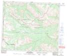
Maps showing Copton Pass, 57-11-W6, Alberta
Copton Pass is a Valley located in 57-11-W6, Alberta and has an elevation of 2126 meters.
- Latitude: 53° 56' 51'' North (decimal: 53.9475000)
- Longitude: 119° 36' 23'' West (decimal: -119.6063888)
- Topography Feature Category: Valley
- Geographical Feature: Pass
- Canadian Province/Territory: Alberta
- Elevation: 2126 meters
- Location: 57-11-W6
- Atlas of Canada Locator Map: Copton Pass
- GPS Coordinate Locator Map: Copton Pass Lat/Long
Copton Pass NTS Map Sheets