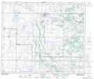
Maps showing Cotton Creek, 23-54-13-W4, Alberta
Cotton Creek is a River located in 23-54-13-W4, Alberta and has an elevation of 611 meters.
- Latitude: 53° 41' 00'' North (decimal: 53.6833333)
- Longitude: 111° 49' 10'' West (decimal: -111.8194444)
- Topography Feature Category: River
- Geographical Feature: Creek
- Canadian Province/Territory: Alberta
- Elevation: 611 meters
- Location: 23-54-13-W4
- Atlas of Canada Locator Map: Cotton Creek
- GPS Coordinate Locator Map: Cotton Creek Lat/Long
Cotton Creek NTS Map Sheets