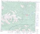
Maps showing Neighbor Creek, 57-10-W6, Alberta
Neighbor Creek is a River located in 57-10-W6, Alberta and has an elevation of 1903 meters.
- Latitude: 53° 55' 41'' North (decimal: 53.9280555)
- Longitude: 119° 24' 56'' West (decimal: -119.4155556)
- Topography Feature Category: River
- Geographical Feature: Creek
- Canadian Province/Territory: Alberta
- Elevation: 1903 meters
- Location: 57-10-W6
- Atlas of Canada Locator Map: Neighbor Creek
- GPS Coordinate Locator Map: Neighbor Creek Lat/Long
Neighbor Creek NTS Map Sheets