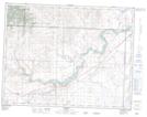
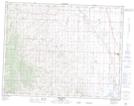
Maps showing Nine Mile Creek, 8-29-W4, Alberta
Nine Mile Creek is a River located in 8-29-W4, Alberta and has an elevation of 1186 meters.
- Latitude: 49° 40' 57'' North (decimal: 49.6825000)
- Longitude: 113° 48' 59'' West (decimal: -113.8163889)
- Topography Feature Category: River
- Geographical Feature: Creek
- Canadian Province/Territory: Alberta
- Elevation: 1186 meters
- Location: 8-29-W4
- Atlas of Canada Locator Map: Nine Mile Creek
- GPS Coordinate Locator Map: Nine Mile Creek Lat/Long
Nine Mile Creek NTS Map Sheets