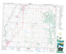
Maps showing Niobe, 3-36-28-W4, Alberta
Niobe is a Unincorporated area located in 3-36-28-W4, Alberta and has an elevation of 925 meters.
- Latitude: 52° 3' 30'' North (decimal: 52.0583333)
- Longitude: 113° 54' 59'' West (decimal: -113.9163888)
- Topography Feature Category: Unincorporated area
- Geographical Feature: Locality
- Canadian Province/Territory: Alberta
- Elevation: 925 meters
- Location: 3-36-28-W4
- Atlas of Canada Locator Map: Niobe
- GPS Coordinate Locator Map: Niobe Lat/Long