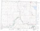
Maps showing Nobleford, 3-11-23-W4, Alberta
Nobleford is a Village located in 3-11-23-W4, Alberta and has an elevation of 987 meters.
- Latitude: 49° 52' 53'' North (decimal: 49.8813888)
- Longitude: 113° 3' 21'' West (decimal: -113.0558332)
- Topography Feature Category: Village
- Geographical Feature: Village
- Canadian Province/Territory: Alberta
- Elevation: 987 meters
- Location: 3-11-23-W4
- Atlas of Canada Locator Map: Nobleford
- GPS Coordinate Locator Map: Nobleford Lat/Long