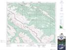
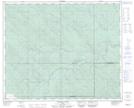
Maps showing Nomad Creek, 45-21-W5, Alberta
Nomad Creek is a River located in 45-21-W5, Alberta and has an elevation of 1645 meters.
- Latitude: 52° 51' 44'' North (decimal: 52.8622221)
- Longitude: 116° 59' 22'' West (decimal: -116.9894443)
- Topography Feature Category: River
- Geographical Feature: Creek
- Canadian Province/Territory: Alberta
- Elevation: 1645 meters
- Location: 45-21-W5
- Atlas of Canada Locator Map: Nomad Creek
- GPS Coordinate Locator Map: Nomad Creek Lat/Long
Nomad Creek NTS Map Sheets