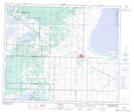
Maps showing Tofield, 1-51-19-W4, Alberta
Tofield is a Town located in 1-51-19-W4, Alberta and has an elevation of 700 meters.
- Latitude: 53° 22' 15'' North (decimal: 53.3708333)
- Longitude: 112° 39' 57'' West (decimal: -112.6658333)
- Topography Feature Category: Town
- Geographical Feature: Town
- Canadian Province/Territory: Alberta
- Elevation: 700 meters
- Location: 1-51-19-W4
- Atlas of Canada Locator Map: Tofield
- GPS Coordinate Locator Map: Tofield Lat/Long