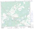
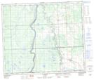
Maps showing Topland, 23-62-7-W5, Alberta
Topland is a Unincorporated area located in 23-62-7-W5, Alberta and has an elevation of 709 meters.
- Latitude: 54° 22' 14'' North (decimal: 54.3705555)
- Longitude: 114° 57' 9'' West (decimal: -114.9524999)
- Topography Feature Category: Unincorporated area
- Geographical Feature: Locality
- Canadian Province/Territory: Alberta
- Elevation: 709 meters
- Location: 23-62-7-W5
- Atlas of Canada Locator Map: Topland
- GPS Coordinate Locator Map: Topland Lat/Long
Topland NTS Map Sheets