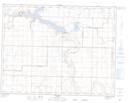
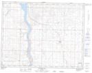
Maps showing Travers Reservoir, 14,15-21,22-W4, Alberta
Travers Reservoir is a Lake located in 14,15-21,22-W4, Alberta and has an elevation of 863 meters.
- Latitude: 50° 13' 10'' North (decimal: 50.2194444)
- Longitude: 112° 50' 22'' West (decimal: -112.8394444)
- Topography Feature Category: Lake
- Geographical Feature: Reservoir
- Canadian Province/Territory: Alberta
- Elevation: 863 meters
- Location: 14,15-21,22-W4
- Atlas of Canada Locator Map: Travers Reservoir
- GPS Coordinate Locator Map: Travers Reservoir Lat/Long
Travers Reservoir NTS Map Sheets