Canada Topographic Maps

Otter River Topo Maps

Topography maps and Latitude/Longitude Location

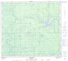
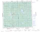
Maps showing Otter River, 33-86-16-W5, Alberta

Otter River is a River located in 33-86-16-W5, Alberta and has an elevation of 671 meters.

  • Latitude: 56° 29' 41'' North   (decimal: 56.4947221)
  • Longitude: 116° 27' 21'' West   (decimal: -116.4558332)
  • Topography Feature Category: River
  • Geographical Feature: River
  • Canadian Province/Territory: Alberta
  • Elevation: 671 meters
  • Location: 33-86-16-W5
  • Atlas of Canada Locator Map: Otter River
  • GPS Coordinate Locator Map: Otter River Lat/Long

Otter River NTS Map Sheets

084B12 No Title Topographic Map at 1:50,000 scale

084B13 Sawn Lake Topographic Map at 1:50,000 scale

084C08 Cadotte Lake Topographic Map at 1:50,000 scale

084C09 Golden Lake Topographic Map at 1:50,000 scale

084C16 Haig Lake Topographic Map at 1:50,000 scale

084B Peerless Lake Topographic Map at 1:250,000 scale

084C Peace River Topographic Map at 1:250,000 scale

 
Buy Topographic Maps DVD
Newsletter Sign-up

Yes, I want to receive map store discounts.


Bookmark and Share