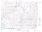
Maps showing Outpost Lake, 7-1-26-W4, Alberta
Outpost Lake is a Lake located in 7-1-26-W4, Alberta and has an elevation of 1389 meters.
- Latitude: 49° 0' 41'' North (decimal: 49.0113888)
- Longitude: 113° 27' 25'' West (decimal: -113.4569444)
- Topography Feature Category: Lake
- Geographical Feature: Lake
- Canadian Province/Territory: Alberta
- Elevation: 1389 meters
- Location: 7-1-26-W4
- Atlas of Canada Locator Map: Outpost Lake
- GPS Coordinate Locator Map: Outpost Lake Lat/Long
Outpost Lake NTS Map Sheets