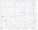
Maps showing Oyen, 34-27-4-W4, Alberta
Oyen is a Town located in 34-27-4-W4, Alberta and has an elevation of 767 meters.
- Latitude: 51° 21' 10'' North (decimal: 51.3527778)
- Longitude: 110° 29' 00'' West (decimal: -110.4833333)
- Topography Feature Category: Town
- Geographical Feature: Town
- Canadian Province/Territory: Alberta
- Elevation: 767 meters
- Location: 34-27-4-W4
- Atlas of Canada Locator Map: Oyen
- GPS Coordinate Locator Map: Oyen Lat/Long