Canada Topographic Maps

Mosquito Creek Topo Maps

Topography maps and Latitude/Longitude Location

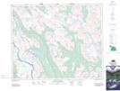
Maps showing Mosquito Creek, Alberta

Mosquito Creek is a River located in Alberta.

  • Latitude: 51° 39' North   (decimal: 51.6500000)
  • Longitude: 116° 23' West   (decimal: -116.3832999)
  • Topography Feature Category: River
  • Geographical Feature: Creek
  • Canadian Province/Territory: Alberta
  • GPS Coordinate Locator Map: Mosquito Creek Lat/Long

Mosquito Creek NTS Map Sheets

082N09 Hector Lake Topographic Map at 1:50,000 scale

082N Golden Topographic Map at 1:250,000 scale

 
Buy Topographic Maps DVD
Newsletter Sign-up

Yes, I want to receive map store discounts.


Bookmark and Share