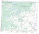
Maps showing Updike Creek, 74-13-W6, Alberta
Updike Creek is a River located in 74-13-W6, Alberta and has an elevation of 786 meters.
- Latitude: 55° 28' 37'' North (decimal: 55.4769444)
- Longitude: 119° 56' 22'' West (decimal: -119.9394443)
- Topography Feature Category: River
- Geographical Feature: Creek
- Canadian Province/Territory: Alberta
- Elevation: 786 meters
- Location: 74-13-W6
- Atlas of Canada Locator Map: Updike Creek
- GPS Coordinate Locator Map: Updike Creek Lat/Long
Updike Creek NTS Map Sheets