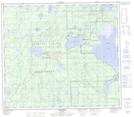
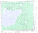
Maps showing Utikuma Lake, 78,79-9,10-W5, Alberta
Utikuma Lake is a Lake located in 78,79-9,10-W5, Alberta and has an elevation of 643 meters.
- Latitude: 55° 50' North (decimal: 55.8333332)
- Longitude: 115° 25' West (decimal: -115.4166667)
- Topography Feature Category: Lake
- Geographical Feature: Lake
- Canadian Province/Territory: Alberta
- Elevation: 643 meters
- Location: 78,79-9,10-W5
- Atlas of Canada Locator Map: Utikuma Lake
- GPS Coordinate Locator Map: Utikuma Lake Lat/Long
Utikuma Lake NTS Map Sheets