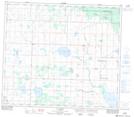
Maps showing Valhalla Centre, 18-74-9-W6, Alberta
Valhalla Centre is a Unincorporated area located in 18-74-9-W6, Alberta and has an elevation of 730 meters.
- Latitude: 55° 24' 13'' North (decimal: 55.4036111)
- Longitude: 119° 22' 55'' West (decimal: -119.3819443)
- Topography Feature Category: Unincorporated area
- Geographical Feature: Hamlet
- Canadian Province/Territory: Alberta
- Elevation: 730 meters
- Location: 18-74-9-W6
- Atlas of Canada Locator Map: Valhalla Centre
- GPS Coordinate Locator Map: Valhalla Centre Lat/Long
Valhalla Centre NTS Map Sheets