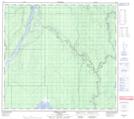
Maps showing Dalkin Island, 30,31-99-9-W4, Alberta
Dalkin Island is a Island located in 30,31-99-9-W4, Alberta and has an elevation of 226 meters.
- Latitude: 57° 38' 11'' North (decimal: 57.6363888)
- Longitude: 111° 27' 28'' West (decimal: -111.4577777)
- Topography Feature Category: Island
- Geographical Feature: Island
- Canadian Province/Territory: Alberta
- Elevation: 226 meters
- Location: 30,31-99-9-W4
- Atlas of Canada Locator Map: Dalkin Island
- GPS Coordinate Locator Map: Dalkin Island Lat/Long
Dalkin Island NTS Map Sheets