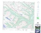
Maps showing Vega Peak, 51-6-W6, Alberta
Vega Peak is a Mountain located in 51-6-W6, Alberta and has an elevation of 2261 meters.
- Latitude: 53° 25' 53'' North (decimal: 53.4313888)
- Longitude: 118° 44' 19'' West (decimal: -118.7386110)
- Topography Feature Category: Mountain
- Geographical Feature: Peak
- Canadian Province/Territory: Alberta
- Elevation: 2261 meters
- Location: 51-6-W6
- Atlas of Canada Locator Map: Vega Peak
- GPS Coordinate Locator Map: Vega Peak Lat/Long
Vega Peak NTS Map Sheets