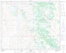
Maps showing Craigmillar, 35-38-7-W4, Alberta
Craigmillar is a Unincorporated area located in 35-38-7-W4, Alberta and has an elevation of 705 meters.
- Latitude: 52° 18' 34'' North (decimal: 52.3094444)
- Longitude: 110° 54' 34'' West (decimal: -110.9094443)
- Topography Feature Category: Unincorporated area
- Geographical Feature: Locality
- Canadian Province/Territory: Alberta
- Elevation: 705 meters
- Location: 35-38-7-W4
- Atlas of Canada Locator Map: Craigmillar
- GPS Coordinate Locator Map: Craigmillar Lat/Long