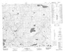
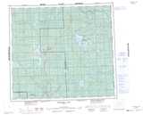
Maps showing Cranberry Lake, 28,29,31,32,33-83-7-W5, Alberta
Cranberry Lake is a Lake located in 28,29,31,32,33-83-7-W5, Alberta and has an elevation of 576 meters.
- Latitude: 56° 14' 5'' North (decimal: 56.2347221)
- Longitude: 115° 4' 39'' West (decimal: -115.0774999)
- Topography Feature Category: Lake
- Geographical Feature: Lake
- Canadian Province/Territory: Alberta
- Elevation: 576 meters
- Location: 28,29,31,32,33-83-7-W5
- Atlas of Canada Locator Map: Cranberry Lake
- GPS Coordinate Locator Map: Cranberry Lake Lat/Long
Cranberry Lake NTS Map Sheets