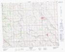
Maps showing Cremona, 3-30-4-W5, Alberta
Cremona is a Village located in 3-30-4-W5, Alberta and has an elevation of 1183 meters.
- Latitude: 51° 32' 44'' North (decimal: 51.5455554)
- Longitude: 114° 29' 33'' West (decimal: -114.4924998)
- Topography Feature Category: Village
- Geographical Feature: Village
- Canadian Province/Territory: Alberta
- Elevation: 1183 meters
- Location: 3-30-4-W5
- Atlas of Canada Locator Map: Cremona
- GPS Coordinate Locator Map: Cremona Lat/Long