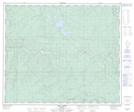
Maps showing Crooked Lake, 63-22-W5, Alberta
Crooked Lake is a Lake located in 63-22-W5, Alberta and has an elevation of 820 meters.
- Latitude: 54° 26' 46'' North (decimal: 54.4461111)
- Longitude: 117° 14' 39'' West (decimal: -117.2441667)
- Topography Feature Category: Lake
- Geographical Feature: Lake
- Canadian Province/Territory: Alberta
- Elevation: 820 meters
- Location: 63-22-W5
- Atlas of Canada Locator Map: Crooked Lake
- GPS Coordinate Locator Map: Crooked Lake Lat/Long
Crooked Lake NTS Map Sheets