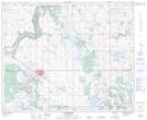
Maps showing Crossing Lake, 44-7-W4, Alberta
Crossing Lake is a Lake located in 44-7-W4, Alberta and has an elevation of 666 meters.
- Latitude: 52° 48' 23'' North (decimal: 52.8063889)
- Longitude: 110° 58' 44'' West (decimal: -110.9788888)
- Topography Feature Category: Lake
- Geographical Feature: Lake
- Canadian Province/Territory: Alberta
- Elevation: 666 meters
- Location: 44-7-W4
- Atlas of Canada Locator Map: Crossing Lake
- GPS Coordinate Locator Map: Crossing Lake Lat/Long
Crossing Lake NTS Map Sheets