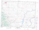
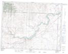
Maps showing Crowlodge Creek, 8-27-W4, Alberta
Crowlodge Creek is a River located in 8-27-W4, Alberta and has an elevation of 1019 meters.
- Latitude: 49° 38' 18'' North (decimal: 49.6383333)
- Longitude: 113° 37' 36'' West (decimal: -113.6266667)
- Topography Feature Category: River
- Geographical Feature: Creek
- Canadian Province/Territory: Alberta
- Elevation: 1019 meters
- Location: 8-27-W4
- Atlas of Canada Locator Map: Crowlodge Creek
- GPS Coordinate Locator Map: Crowlodge Creek Lat/Long
Crowlodge Creek NTS Map Sheets