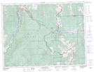
Maps showing Crowsnest Pass, 8-6-W5, Alberta
Crowsnest Pass is a Valley located in 8-6-W5, Alberta and has an elevation of 1380 meters.
- Latitude: 49° 37' 41'' North (decimal: 49.6280555)
- Longitude: 114° 40' 31'' West (decimal: -114.6752778)
- Topography Feature Category: Valley
- Geographical Feature: Pass
- Canadian Province/Territory: Alberta
- Elevation: 1380 meters
- Location: 8-6-W5
- Atlas of Canada Locator Map: Crowsnest Pass
- GPS Coordinate Locator Map: Crowsnest Pass Lat/Long