Canada Topographic Maps

Crownest Pass Topo Maps

Topography maps and Latitude/Longitude Location

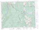
Maps showing Crownest Pass, Alberta

Crownest Pass is a Valley located in Alberta.

  • Latitude: 49° 38' North   (decimal: 49.6333000)
  • Longitude: 114° 40' West   (decimal: -114.6667000)
  • Topography Feature Category: Valley
  • Geographical Feature: Pass
  • Canadian Province/Territory: Alberta
  • GPS Coordinate Locator Map: Crownest Pass Lat/Long

Crownest Pass NTS Map Sheets

082G10 Crowsnest Topographic Map at 1:50,000 scale

082G Fernie Topographic Map at 1:250,000 scale

 
Buy Topographic Maps DVD
Newsletter Sign-up

Yes, I want to receive map store discounts.


Bookmark and Share