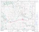
Maps showing Crystal Lake, 29-50-10-W4, Alberta
Crystal Lake is a Lake located in 29-50-10-W4, Alberta and has an elevation of 651 meters.
- Latitude: 53° 21' 0'' North (decimal: 53.3500000)
- Longitude: 111° 26' 3'' West (decimal: -111.4341667)
- Topography Feature Category: Lake
- Geographical Feature: Lake
- Canadian Province/Territory: Alberta
- Elevation: 651 meters
- Location: 29-50-10-W4
- Atlas of Canada Locator Map: Crystal Lake
- GPS Coordinate Locator Map: Crystal Lake Lat/Long
Crystal Lake NTS Map Sheets