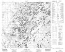
Maps showing Currie Lake, 104-5-W4, Alberta
Currie Lake is a Lake located in 104-5-W4, Alberta and has an elevation of 300 meters.
- Latitude: 58° 3' 17'' North (decimal: 58.0547221)
- Longitude: 110° 44' 30'' West (decimal: -110.7416666)
- Topography Feature Category: Lake
- Geographical Feature: Lake
- Canadian Province/Territory: Alberta
- Elevation: 300 meters
- Location: 104-5-W4
- Atlas of Canada Locator Map: Currie Lake
- GPS Coordinate Locator Map: Currie Lake Lat/Long
Currie Lake NTS Map Sheets