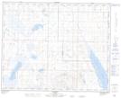
Maps showing Cutbank Lake, 35-35-17-W4, Alberta
Cutbank Lake is a Lake located in 35-35-17-W4, Alberta and has an elevation of 833 meters.
- Latitude: 52° 3' 22'' North (decimal: 52.0561110)
- Longitude: 112° 19' 15'' West (decimal: -112.3208333)
- Topography Feature Category: Lake
- Geographical Feature: Lake
- Canadian Province/Territory: Alberta
- Elevation: 833 meters
- Location: 35-35-17-W4
- Atlas of Canada Locator Map: Cutbank Lake
- GPS Coordinate Locator Map: Cutbank Lake Lat/Long