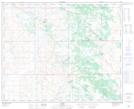
Maps showing Czar, 20-40-6-W4, Alberta
Czar is a Village located in 20-40-6-W4, Alberta and has an elevation of 684 meters.
- Latitude: 52° 27' 17'' North (decimal: 52.4547222)
- Longitude: 110° 49' 42'' West (decimal: -110.8283333)
- Topography Feature Category: Village
- Geographical Feature: Village
- Canadian Province/Territory: Alberta
- Elevation: 684 meters
- Location: 20-40-6-W4
- Atlas of Canada Locator Map: Czar
- GPS Coordinate Locator Map: Czar Lat/Long