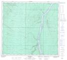
Maps showing Daphne Island, 95-11-W4, Alberta
Daphne Island is a Island located in 95-11-W4, Alberta and has an elevation of 237 meters.
- Latitude: 57° 16' 45'' North (decimal: 57.2791666)
- Longitude: 111° 39' 41'' West (decimal: -111.6613888)
- Topography Feature Category: Island
- Geographical Feature: Island
- Canadian Province/Territory: Alberta
- Elevation: 237 meters
- Location: 95-11-W4
- Atlas of Canada Locator Map: Daphne Island
- GPS Coordinate Locator Map: Daphne Island Lat/Long
Daphne Island NTS Map Sheets