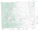
Maps showing North Fork, 10-9-1-W5, Alberta
North Fork is a Unincorporated area located in 10-9-1-W5, Alberta and has an elevation of 1336 meters.
- Latitude: 49° 44' North (decimal: 49.7332999)
- Longitude: 114° 3' West (decimal: -114.0499999)
- Topography Feature Category: Unincorporated area
- Geographical Feature: Post Office
- Canadian Province/Territory: Alberta
- Elevation: 1336 meters
- Location: 10-9-1-W5
- GPS Coordinate Locator Map: North Fork Lat/Long