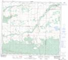
Maps showing Northmark, 20-76-6-W6, Alberta
Northmark is a Unincorporated area located in 20-76-6-W6, Alberta and has an elevation of 704 meters.
- Latitude: 55° 36' 22'' North (decimal: 55.6061111)
- Longitude: 118° 54' 16'' West (decimal: -118.9044443)
- Topography Feature Category: Unincorporated area
- Geographical Feature: Locality
- Canadian Province/Territory: Alberta
- Elevation: 704 meters
- Location: 20-76-6-W6
- Atlas of Canada Locator Map: Northmark
- GPS Coordinate Locator Map: Northmark Lat/Long
Northmark NTS Map Sheets