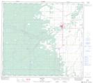
Maps showing North Star, 32-90-23-W5, Alberta
North Star is a Unincorporated area located in 32-90-23-W5, Alberta and has an elevation of 488 meters.
- Latitude: 56° 51' 23'' North (decimal: 56.8563889)
- Longitude: 117° 36' 55'' West (decimal: -117.6152778)
- Topography Feature Category: Unincorporated area
- Geographical Feature: Hamlet
- Canadian Province/Territory: Alberta
- Elevation: 488 meters
- Location: 32-90-23-W5
- Atlas of Canada Locator Map: North Star
- GPS Coordinate Locator Map: North Star Lat/Long
North Star NTS Map Sheets