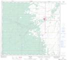
Maps showing Notikewin, 16-92-23-W5, Alberta
Notikewin is a Unincorporated area located in 16-92-23-W5, Alberta and has an elevation of 480 meters.
- Latitude: 56° 58' 29'' North (decimal: 56.9747221)
- Longitude: 117° 37' 30'' West (decimal: -117.6249999)
- Topography Feature Category: Unincorporated area
- Geographical Feature: Hamlet
- Canadian Province/Territory: Alberta
- Elevation: 480 meters
- Location: 16-92-23-W5
- Atlas of Canada Locator Map: Notikewin
- GPS Coordinate Locator Map: Notikewin Lat/Long
Notikewin NTS Map Sheets