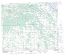
Maps showing Nugent, 11-44-3-W5, Alberta
Nugent is a Unincorporated area located in 11-44-3-W5, Alberta.
- Latitude: 52° 46' 53'' North (decimal: 52.7813888)
- Longitude: 114° 19' 5'' West (decimal: -114.3180556)
- Topography Feature Category: Unincorporated area
- Geographical Feature: Locality
- Canadian Province/Territory: Alberta
- Location: 11-44-3-W5
- Atlas of Canada Locator Map: Nugent
- GPS Coordinate Locator Map: Nugent Lat/Long
Nugent NTS Map Sheets