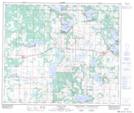
Maps showing Vilna, 20-59-13-W4, Alberta
Vilna is a Village located in 20-59-13-W4, Alberta and has an elevation of 641 meters.
- Latitude: 54° 7' 00'' North (decimal: 54.1166666)
- Longitude: 111° 55' 15'' West (decimal: -111.9208333)
- Topography Feature Category: Village
- Geographical Feature: Village
- Canadian Province/Territory: Alberta
- Elevation: 641 meters
- Location: 20-59-13-W4
- Atlas of Canada Locator Map: Vilna
- GPS Coordinate Locator Map: Vilna Lat/Long
Vilna NTS Map Sheets