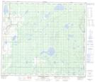
Maps showing Wandering River, 6-72-16-W4, Alberta
Wandering River is a Unincorporated area located in 6-72-16-W4, Alberta and has an elevation of 567 meters.
- Latitude: 55° 11' 44'' North (decimal: 55.1955555)
- Longitude: 112° 28' 31'' West (decimal: -112.4752777)
- Topography Feature Category: Unincorporated area
- Geographical Feature: Locality
- Canadian Province/Territory: Alberta
- Elevation: 567 meters
- Location: 6-72-16-W4
- Atlas of Canada Locator Map: Wandering River
- GPS Coordinate Locator Map: Wandering River Lat/Long
Wandering River NTS Map Sheets