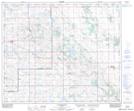
Maps showing Lac Tremble, 30-52-4-W4, Alberta
Lac Tremble is a Lake located in 30-52-4-W4, Alberta and has an elevation of 608 meters.
- Latitude: 53° 30' 49'' North (decimal: 53.5136109)
- Longitude: 110° 35' 8'' West (decimal: -110.5855555)
- Topography Feature Category: Lake
- Geographical Feature: Lake
- Canadian Province/Territory: Alberta
- Elevation: 608 meters
- Location: 30-52-4-W4
- Atlas of Canada Locator Map: Lac Tremble
- GPS Coordinate Locator Map: Lac Tremble Lat/Long
Lac Tremble NTS Map Sheets