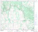
Maps showing Truman, 19-63-8-W4, Alberta
Truman is a Unincorporated area located in 19-63-8-W4, Alberta and has an elevation of 571 meters.
- Latitude: 54° 27' 32'' North (decimal: 54.4588889)
- Longitude: 111° 12' 15'' West (decimal: -111.2041666)
- Topography Feature Category: Unincorporated area
- Geographical Feature: Locality
- Canadian Province/Territory: Alberta
- Elevation: 571 meters
- Location: 19-63-8-W4
- Atlas of Canada Locator Map: Truman
- GPS Coordinate Locator Map: Truman Lat/Long
Truman NTS Map Sheets