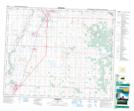
Maps showing Tuttle, 30-37-27-W4, Alberta
Tuttle is a Unincorporated area located in 30-37-27-W4, Alberta and has an elevation of 891 meters.
- Latitude: 52° 12' 27'' North (decimal: 52.2075000)
- Longitude: 113° 50' 42'' West (decimal: -113.8450000)
- Topography Feature Category: Unincorporated area
- Geographical Feature: Locality
- Canadian Province/Territory: Alberta
- Elevation: 891 meters
- Location: 30-37-27-W4
- Atlas of Canada Locator Map: Tuttle
- GPS Coordinate Locator Map: Tuttle Lat/Long