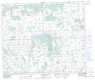
Maps showing Twin Lakes, 58,59-6-W5, Alberta
Twin Lakes is a Lake located in 58,59-6-W5, Alberta and has an elevation of 647 meters.
- Latitude: 54° 3' 34'' North (decimal: 54.0594444)
- Longitude: 114° 47' 4'' West (decimal: -114.7844444)
- Topography Feature Category: Lake
- Geographical Feature: Lakes
- Canadian Province/Territory: Alberta
- Elevation: 647 meters
- Location: 58,59-6-W5
- Atlas of Canada Locator Map: Twin Lakes
- GPS Coordinate Locator Map: Twin Lakes Lat/Long
Twin Lakes NTS Map Sheets