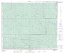
Maps showing Two Creek, 61-16-W5, Alberta
Two Creek is a River located in 61-16-W5, Alberta and has an elevation of 981 meters.
- Latitude: 54° 15' 18'' North (decimal: 54.2549999)
- Longitude: 116° 15' 28'' West (decimal: -116.2577778)
- Topography Feature Category: River
- Geographical Feature: Creek
- Canadian Province/Territory: Alberta
- Elevation: 981 meters
- Location: 61-16-W5
- Atlas of Canada Locator Map: Two Creek
- GPS Coordinate Locator Map: Two Creek Lat/Long
Two Creek NTS Map Sheets