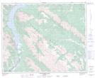
Maps showing Two O'Clock Creek, 5-36-17-W5, Alberta
Two O'Clock Creek is a River located in 5-36-17-W5, Alberta.
- Latitude: 52° 3' 55'' North (decimal: 52.0652778)
- Longitude: 116° 24' 15'' West (decimal: -116.4041667)
- Topography Feature Category: River
- Geographical Feature: Creek
- Canadian Province/Territory: Alberta
- Location: 5-36-17-W5
- Atlas of Canada Locator Map: Two O'Clock Creek
- GPS Coordinate Locator Map: Two O'Clock Creek Lat/Long
Two O'Clock Creek NTS Map Sheets