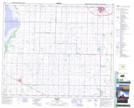
Maps showing Waskwei Creek, 13-52-14-W4, Alberta
Waskwei Creek is a River located in 13-52-14-W4, Alberta and has an elevation of 674 meters.
- Latitude: 53° 27' 36'' North (decimal: 53.4600000)
- Longitude: 112° 5' 3'' West (decimal: -112.0841667)
- Topography Feature Category: River
- Geographical Feature: Creek
- Canadian Province/Territory: Alberta
- Elevation: 674 meters
- Location: 13-52-14-W4
- Atlas of Canada Locator Map: Waskwei Creek
- GPS Coordinate Locator Map: Waskwei Creek Lat/Long