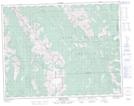
Maps showing Weary Creek Gap, 16-7-W5, Alberta
Weary Creek Gap is a Valley located in 16-7-W5, Alberta and has an elevation of 2252 meters.
- Latitude: 50° 23' 53'' North (decimal: 50.3980555)
- Longitude: 114° 51' 12'' West (decimal: -114.8533332)
- Topography Feature Category: Valley
- Geographical Feature: Gap
- Canadian Province/Territory: Alberta
- Elevation: 2252 meters
- Location: 16-7-W5
- Atlas of Canada Locator Map: Weary Creek Gap
- GPS Coordinate Locator Map: Weary Creek Gap Lat/Long
Weary Creek Gap NTS Map Sheets