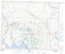
Maps showing Whitebrush Lake, 42-20-W4, Alberta
Whitebrush Lake is a Lake located in 42-20-W4, Alberta and has an elevation of 789 meters.
- Latitude: 52° 36' 39'' North (decimal: 52.6108333)
- Longitude: 112° 51' 37'' West (decimal: -112.8602777)
- Topography Feature Category: Lake
- Geographical Feature: Lake
- Canadian Province/Territory: Alberta
- Elevation: 789 meters
- Location: 42-20-W4
- Atlas of Canada Locator Map: Whitebrush Lake
- GPS Coordinate Locator Map: Whitebrush Lake Lat/Long