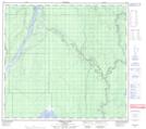
Maps showing Dalkin Island, Alberta
Dalkin Island is a Island located in Alberta.
- Latitude: 57° 38' North (decimal: 57.6333000)
- Longitude: 111° 28' West (decimal: -111.4667000)
- Topography Feature Category: Island
- Geographical Feature: Island
- Canadian Province/Territory: Alberta
- GPS Coordinate Locator Map: Dalkin Island Lat/Long
Dalkin Island NTS Map Sheets