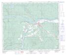
Maps showing Whitecourt Creek, Alberta
Whitecourt Creek is a River located in Alberta.
- Latitude: 54° 8' 40'' North (decimal: 54.1444000)
- Longitude: 115° 41' 45'' West (decimal: -115.6957999)
- Topography Feature Category: River
- Geographical Feature: Creek
- Canadian Province/Territory: Alberta
- GPS Coordinate Locator Map: Whitecourt Creek Lat/Long
Whitecourt Creek NTS Map Sheets